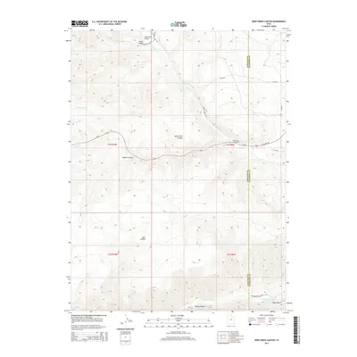
2014 Map of Deep Creek Canyon
USGS Topo · Published 2014About this map
The high mountain drainage of the Strawberry River and its northern tributaries define this landscape along the border of Wasatch and Duchesne counties. A significant corridor for travel and recreation, the area is bisected by Us-40, which follows the descent from the high plateau into Deep Creek Canyon. This topographical study reveals the complex network of drainages that feed the river system, including Wildcat Canyon, Beaver Canyon, and Slab Canyon. Human activity is concentrated along the arterial roads, marked by the Racetrack Campground near the confluence of Currant Cr and Deep Cr. The map captures the transition from the high, dry draws of Little Dry Hollow and Water Hollow in the north down to the riparian bottomlands of the Strawberry River in the south, illustrating the drainage patterns and access routes used by ranchers and outdoorsmen in the early twenty-first century.
Find a feature on this map
25 named features on this map. Tap any name to fly to it.
Don’t see what you’re looking for? This feature index may not catch every label — zoom into the map to look around manually.
Map Details
Editions of this 2014 Deep Creek Canyon Map
This is the sole edition of this map. No revisions or reprints were ever made.
Other maps of this area

1885 · Salt Lake
USGS Topo · 1:250,000

1885 · Uinta
USGS Topo · 1:250,000

1907 · Strawberry Valley
USGS Topo · 1:125,000

1909 · Strawberry Valley
USGS Topo · 1:125,000

1954 · Salt Lake City
USGS Topo · 1:250,000

1958 · Salt Lake City
USGS Topo · 1:250,000

1960 · Salt Lake City
USGS Topo · 1:250,000

1962 · Deep Creek Canyon
USGS Topo · 1:24,000

1962 · Fruitland
USGS Topo · 1:24,000

1962 · Raspberry Knoll
USGS Topo · 1:24,000