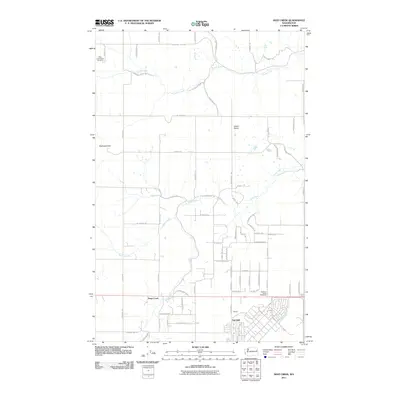
2011 Map of Deep Creek
USGS Topo · Published 2011About this map
Spokane Plains Battlefield anchors the southeastern landscape of this region, preserving the site of a significant historical conflict in Spokane County. The terrain transitions from the elevations of McDowell Hill in the west to the open expanse of Indian Prairie, reflecting a transition between basaltic plateaus and fertile agricultural lands. The community of Deep Creek and the neighboring settlements of Galena and Fairchild demonstrate a pattern of development influenced by both the natural watercourses of Coulee Creek and Spring Creek and more modern infrastructure.
Find a feature on this map
65 named features on this map. Tap any name to fly to it.
Don’t see what you’re looking for? This feature index may not catch every label — zoom into the map to look around manually.
Map Details
Editions of this 2011 Deep Creek Map
This is the sole edition of this map. No revisions or reprints were ever made.
Other maps of this area

1943 · Medical Lake
USGS Topo · 1:62,500

1944 · Clayton
USGS Topo · 1:62,500

1944 · Wellpinit
USGS Topo · 1:62,500

1945 · Reardan
USGS Topo · 1:62,500

1950 · Clayton
USGS Topo · 1:62,500

1953 · Reardan
USGS Topo · 1:62,500

1953 · Wellpinit
USGS Topo · 1:62,500

1954 · Airway Heights
USGS Topo · 1:24,000

1954 · Medical Lake
USGS Topo · 1:24,000

1954 · Medical Lake
USGS Topo · 1:62,500