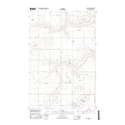
2017 Map of Deep Creek
USGS Topo · Published 2017About this map
Fairchild AFB dominates the southeast corner of this landscape, a significant military installation situated on the flat expanse of Indian Prairie. The terrain transition is marked by McDowell Hill to the west, while the hydrological network of Deep Creek, Coulee Cr, and Spring Cr carves across the prairie floor. Historical land use and community markers are preserved in the presence of the West Greenwood Cem and smaller aviation facilities like Isaacson Airport.
Find a feature on this map
82 named features on this map. Tap any name to fly to it.
Don’t see what you’re looking for? This feature index may not catch every label — zoom into the map to look around manually.
Map Details
Editions of this 2017 Deep Creek Map
This is the sole edition of this map. No revisions or reprints were ever made.
Other maps of this area

1943 · Medical Lake
USGS Topo · 1:62,500

1944 · Clayton
USGS Topo · 1:62,500

1944 · Wellpinit
USGS Topo · 1:62,500

1945 · Reardan
USGS Topo · 1:62,500

1950 · Clayton
USGS Topo · 1:62,500

1953 · Reardan
USGS Topo · 1:62,500

1953 · Wellpinit
USGS Topo · 1:62,500

1954 · Airway Heights
USGS Topo · 1:24,000

1954 · Medical Lake
USGS Topo · 1:24,000

1954 · Medical Lake
USGS Topo · 1:62,500