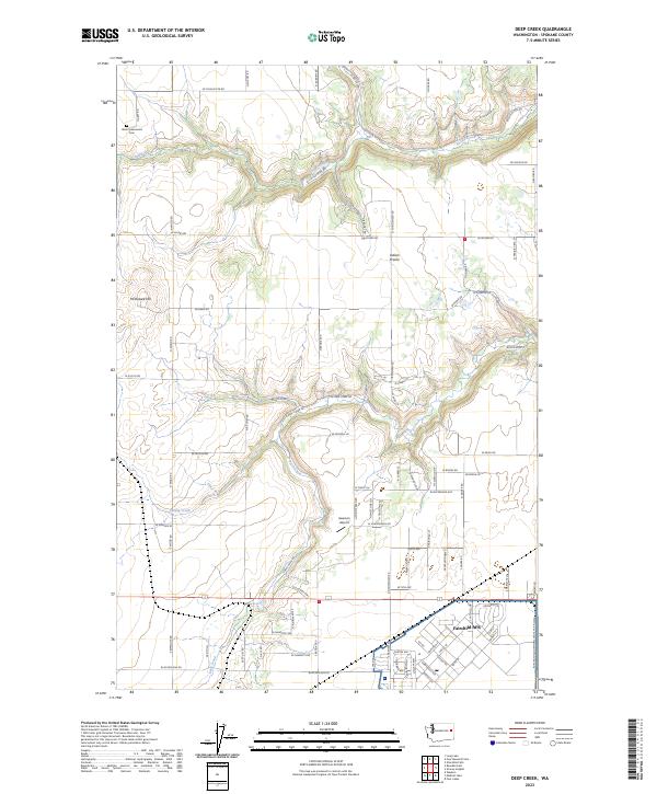
2023 Map of Deep Creek
USGS Topo · Published 2023About this map
Fairchild AFB dominates the southern landscape of this Spokane County quadrangle, showing the extensive infrastructure of the base alongside the Burlington Northern Santa Fe Railway. The terrain transitions from the developed military grounds into the broad expanse of Indian Prairie, where a network of rural roads like W Coulee Hite Rd and N Brooks Rd connects agricultural lands. Waterways including Coulee Creek and Deep Creek carve through the topography, which rises toward McDowell Hill in the west.
Find a feature on this map
87 named features on this map. Tap any name to fly to it.
Don’t see what you’re looking for? This feature index may not catch every label — zoom into the map to look around manually.
Map Details
Editions of this 2023 Deep Creek Map
This is the sole edition of this map. No revisions or reprints were ever made.
Other maps of this area

1943 · Medical Lake
USGS Topo · 1:62,500

1944 · Clayton
USGS Topo · 1:62,500

1944 · Wellpinit
USGS Topo · 1:62,500

1945 · Reardan
USGS Topo · 1:62,500

1950 · Clayton
USGS Topo · 1:62,500

1953 · Reardan
USGS Topo · 1:62,500

1953 · Wellpinit
USGS Topo · 1:62,500

1954 · Airway Heights
USGS Topo · 1:24,000

1954 · Medical Lake
USGS Topo · 1:24,000

1954 · Medical Lake
USGS Topo · 1:62,500