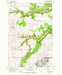
1963 Map of Deep Creek
USGS Topo · Published 1964About this map
Fairchild Air Force Base dominates the southern landscape of this 1963 survey, illustrating the significant military footprint in Spokane County during the Cold War. The base's expansive runways and housing areas like Fairchild contrast with the surrounding agricultural terrain and the winding course of Deep Creek. This geography preserves a layering of regional history, where the modern airfield sits adjacent to the Spokane Battlefield State Park.
Find a feature on this map
31 named features on this map. Tap any name to fly to it.
Don’t see what you’re looking for? This feature index may not catch every label — zoom into the map to look around manually.
Map Details
Editions of this 1963 Deep Creek Map
This is the sole edition of this map. No revisions or reprints were ever made.
Other maps of this area

1943 · Medical Lake
USGS Topo · 1:62,500

1944 · Clayton
USGS Topo · 1:62,500

1944 · Wellpinit
USGS Topo · 1:62,500

1945 · Reardan
USGS Topo · 1:62,500

1950 · Clayton
USGS Topo · 1:62,500

1953 · Reardan
USGS Topo · 1:62,500

1953 · Wellpinit
USGS Topo · 1:62,500

1954 · Airway Heights
USGS Topo · 1:24,000

1954 · Medical Lake
USGS Topo · 1:24,000

1954 · Medical Lake
USGS Topo · 1:62,500