
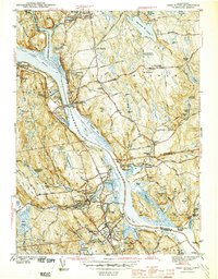
1944 Map of Deep River
USGS Topo · Published 1944About this map
Deep River and Chester serve as focal points for this 1940s-era topographic survey, which captures the river-dependent economy of the lower Connecticut River valley before major post-war development. The New York New Haven and Hartford Railroad snakes along the western bank, connecting small hamlets like Shailerville and Tylerville, while the East Haddam Bridge provides a vital link across the water.
Find a feature on this map
118 named features on this map. Tap any name to fly to it.
Don’t see what you’re looking for? This feature index may not catch every label — zoom into the map to look around manually.
Map Details
Editions of this 1944 Deep River Map
2 editions found
Other maps of this area

1892 · Gilead
USGS Topo · 1:62,500

1893 · Guilford
USGS Topo · 1:62,500

1893 · Middletown
USGS Topo · 1:62,500

1893 · Saybrook
USGS Topo · 1:62,500

1906 · Farmington
USGS Topo · 1:125,000

1941 · Lyme
USGS Topo · 1:31,680

1944 · Essex
USGS Topo · 1:31,680

1945 · Middle Haddam
USGS Topo · 1:31,680
1945 · Colchester
USGS Topo · 1:31,680
1946 · Moodus
USGS Topo · 1:31,680