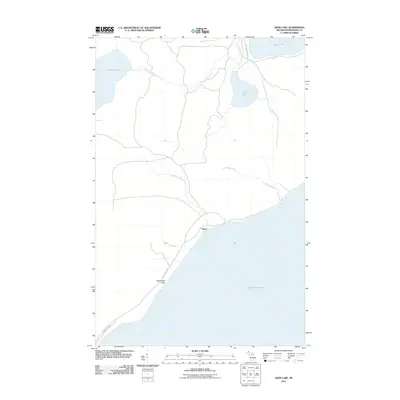
2011 Map of Deer Lake
USGS Topo · Published 2011About this map
Lake Superior dominates the southern reaches of this Keweenaw County shoreline, where the small settlement of Betsy sits along the sheltered waters of Betsy Bay. The landscape is defined by a dense network of freshwater systems, including the inland basins of Lake Gratiot, Deer Lake, and a portion of Lac La Belle to the northeast. Water moves through the terrain via the Little Gratiot River and the branching paths of the Big Betsy River and Little Betsy River, illustrating the complex drainage of this northern peninsula. Along the coast, Black Rock Point serves as a prominent geographic marker near the intersection of Hermits Cove Rd and Lac La Belle Rd. The map reveals a sparsely developed region where traditional roads follow the natural contours of the lakefront and river valleys, preserving the quiet character of the Michigan wilderness.
Find a feature on this map
13 named features on this map. Tap any name to fly to it.
Don’t see what you’re looking for? This feature index may not catch every label — zoom into the map to look around manually.
Map Details
Editions of this 2011 Deer Lake Map
This is the sole edition of this map. No revisions or reprints were ever made.
Other maps of this area

1927 · Point Isabelle
USGS Topo · 1:31,680

1938 · Bruneau Creek
USGS Topo · 1:31,680

1938 · Gay
USGS Topo · 1:31,680

1938 · Delaware
USGS Topo · 1:31,680

1939 · Deer Lake
USGS Topo · 1:31,680

1939 · Delaware
USGS Topo · 1:31,680

1940 · Deer Lake
USGS Topo · 1:31,680

1940 · Central
USGS Topo · 1:31,680

1940 · Lake Medora
USGS Topo · 1:31,680

1946 · Bruneau Creek
USGS Topo · 1:24,000