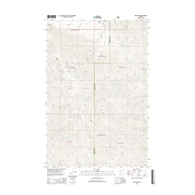
2014 Map of Deer Peak
USGS Topo · Published 2014About this map
Lolo National Forest encompasses the majority of this Missoula County landscape, where the high point at Deer Peak overlooks a network of drainages and timbered ridges. The terrain is defined by deep cuts such as Ruben Gulch and Sawmill Gulch, with a complex system of Forest Service roads including Ryegate and Upper Ed's providing access to the interior. Small mountain streams like Huy Cr, Beaver Slough Cr, and the W Fork Petty Cr carve through the topography, reflecting a landscape primarily managed for resource protection and forestry. The western boundary of the map follows the line between Mineral and Missoula counties, cutting across the western slopes of Ed's Ridge. For those tracking historical land use, the map details the transition from named gulches to the high-elevation peaks that dominate this portion of the Montana wilderness.
Find a feature on this map
27 named features on this map. Tap any name to fly to it.
Don’t see what you’re looking for? This feature index may not catch every label — zoom into the map to look around manually.
Map Details
Editions of this 2014 Deer Peak Map
This is the sole edition of this map. No revisions or reprints were ever made.
Other maps of this area

1911 · Lolo
USGS Topo · 1:250,000

1912 · Missoula
USGS Topo · 1:125,000

1913 · Lolo
USGS Topo · 1:250,000

1956 · Wallace
USGS Topo · 1:250,000

1956 · Hamilton
USGS Topo · 1:250,000

1959 · Hamilton
USGS Topo · 1:250,000

1959 · Tarkio
USGS Topo · 1:62,500

1959 · Alberton
USGS Topo · 1:62,500

1960 · Wallace
USGS Topo · 1:250,000

1960 · Hamilton
USGS Topo · 1:250,000