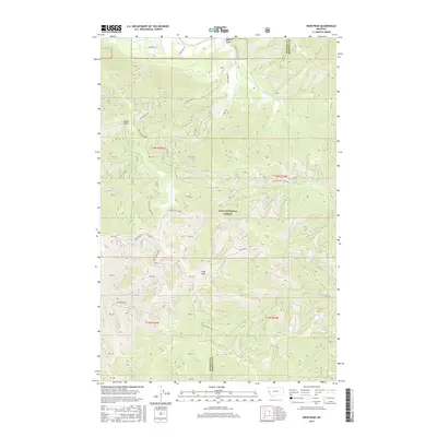
2017 Map of Deer Peak
USGS Topo · Published 2017About this map
The Lolo National Forest dominates this section of the Northern Rockies, where the boundary between Missoula and Mineral counties follows high ridgelines and drainage divides. The terrain is defined by a series of steep gulches and ridges, most notably Ed's Ridge and the prominent Deer Peak. Water drainage patterns are clearly marked by the W Fork Petty Creek and Beaver Slough, which carve through the heavily forested landscape. The map provides a detailed view of the forest road network that facilitated access for timber management and fire suppression during this era, including W Fork Petty Creek Rd and Eds Creek Rd. Several family-named or descriptive landmarks like Sawmill Gulch, Ruben Gulch, and Pleasant Valley indicate early twentieth-century activity and land use within the rugged interior of the national forest system.
Find a feature on this map
45 named features on this map. Tap any name to fly to it.
Don’t see what you’re looking for? This feature index may not catch every label — zoom into the map to look around manually.
Map Details
Editions of this 2017 Deer Peak Map
This is the sole edition of this map. No revisions or reprints were ever made.
Other maps of this area

1911 · Lolo
USGS Topo · 1:250,000

1912 · Missoula
USGS Topo · 1:125,000

1913 · Lolo
USGS Topo · 1:250,000

1956 · Wallace
USGS Topo · 1:250,000

1956 · Hamilton
USGS Topo · 1:250,000

1959 · Hamilton
USGS Topo · 1:250,000

1959 · Tarkio
USGS Topo · 1:62,500

1959 · Alberton
USGS Topo · 1:62,500

1960 · Wallace
USGS Topo · 1:250,000

1960 · Hamilton
USGS Topo · 1:250,000