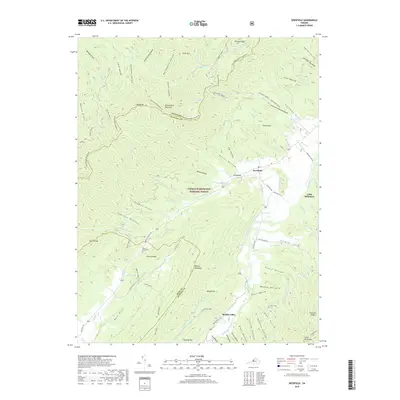
2019 Map of Deerfield
USGS Topo · Published 2019About this map
The Calfpasture River valley serves as the primary corridor for settlement in this portion of the George Washington National Forest. The village of Deerfield sits at a crossroads where Holloway Draft and Hamilton Br meet the main river, surrounded by the significant elevations of Shenandoah Mountain and Walker Mountain. This 2019 survey documents a landscape of named hollows and drafts, reflecting a long history of local land usage and family-named landmarks such as Tizzle Flats and Guy Hollow.
Find a feature on this map
81 named features on this map. Tap any name to fly to it.
Don’t see what you’re looking for? This feature index may not catch every label — zoom into the map to look around manually.
Map Details
Editions of this 2019 Deerfield Map
This is the sole edition of this map. No revisions or reprints were ever made.
Other maps of this area

1894 · Staunton
USGS Topo · 1:125,000

1901 · Monterey
USGS Topo · 1:125,000

1924 · Mc Dowell
USGS Topo · 1:62,500

1941 · Monterey
USGS Topo · 1:62,500

1943 · Craigsville
USGS Topo · 1:62,500

1944 · Monterey
USGS Topo · 1:62,500

1944 · Mc Dowell
USGS Topo · 1:62,500

1945 · Craigsville
USGS Topo · 1:62,500

1946 · Mc Dowell
USGS Topo · 1:62,500

1946 · Williamsville
USGS Topo · 1:62,500