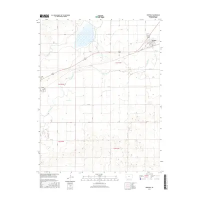
2016 Map of Deerfield
USGS Topo · Published 2016About this map
Deerfield and Lakin anchor this portion of the High Plains, situated along the northern bank of the Arkansas River. The landscape is a testament to the region's sophisticated water management, essential for Western Kansas agriculture. Early 21st-century irrigation infrastructure is highly visible through the paths of the Amazon Ditch and Martin Ditch, which redirect water across the arid terrain. Lake McKinney serves as a prominent reservoir in the north-central portion of the quadrangle, illustrating the modification of the natural environment to support local settlement and industry.
Find a feature on this map
39 named features on this map. Tap any name to fly to it.
Don’t see what you’re looking for? This feature index may not catch every label — zoom into the map to look around manually.
Map Details
Editions of this 2016 Deerfield Map
This is the sole edition of this map. No revisions or reprints were ever made.
Other maps of this area

1891 · Larned
USGS Topo · 1:125,000

1900 · Lakin
USGS Topo · 1:125,000

1955 · Dodge City
USGS Topo · 1:250,000

1955 · Scott City
USGS Topo · 1:250,000

1958 · Dodge City
USGS Topo · 1:250,000

1958 · Scott City
USGS Topo · 1:250,000

1959 · Dodge City
USGS Topo · 1:250,000
1960 · Deerfield SE
USGS Topo · 1:24,000
1960 · Deerfield SW
USGS Topo · 1:24,000

1960 · Deerfield
USGS Topo · 1:24,000