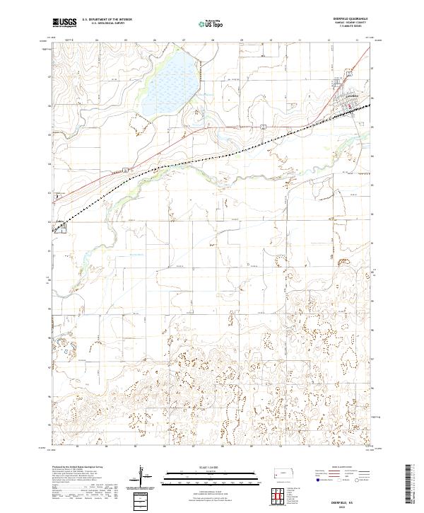
2022 Map of Deerfield
USGS Topo · Published 2022About this map
Deerfield and Lakin anchor this western Kansas landscape in Kearny County, where the plains meet the vital waters of the Arkansas River. The region's agricultural dependency is clearly traced through an intricate network of irrigation systems, including the Amazon Ditch and Martin Ditch, which channel water toward the expansive Lake McKinney. This 2022 survey details the grid-patterned growth of the settlements, with street-level accuracy for roads such as Main St and Sixth Ave in Deerfield.
Find a feature on this map
41 named features on this map. Tap any name to fly to it.
Don’t see what you’re looking for? This feature index may not catch every label — zoom into the map to look around manually.
Map Details
Editions of this 2022 Deerfield Map
This is the sole edition of this map. No revisions or reprints were ever made.
Other maps of this area

1891 · Larned
USGS Topo · 1:125,000

1900 · Lakin
USGS Topo · 1:125,000

1955 · Dodge City
USGS Topo · 1:250,000

1955 · Scott City
USGS Topo · 1:250,000

1958 · Dodge City
USGS Topo · 1:250,000

1958 · Scott City
USGS Topo · 1:250,000

1959 · Dodge City
USGS Topo · 1:250,000
1960 · Deerfield SE
USGS Topo · 1:24,000
1960 · Deerfield SW
USGS Topo · 1:24,000

1960 · Deerfield
USGS Topo · 1:24,000