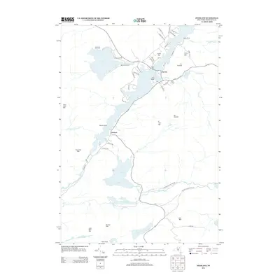
2013 Map of Deerland
USGS Topo · Published 2013About this map
Long Lake and its surrounding mountain peaks dominate this early 21st-century topographic study of the central Adirondacks. The settlement of Deerland sits at the junction of the lake and its southern inlets, while the village of Long Lake serves as a hub of activity further north, evidenced by the Po, Long Lake Cem, and the prominent Long Lake Bridge. This era shows a landscape managed for recreation and conservation, with the Adirondack Park Preserve and Lake Eaton State Camp providing public access to the wilderness. Significant hiking infrastructure is present, notably the Northville Lake Placid Trl winding through the southeast. The map details a complex water system where the Raquette River flows near Buttermilk Falls, connecting various high-altitude basins like Minnow Pond and South Pond beneath the shadows of Mt Sabattis and Owls Head Mtn.
Find a feature on this map
67 named features on this map. Tap any name to fly to it.
Don’t see what you’re looking for? This feature index may not catch every label — zoom into the map to look around manually.
Map Details
Editions of this 2013 Deerland Map
This is the sole edition of this map. No revisions or reprints were ever made.
Other maps of this area

1903 · Raquette Lake
USGS Topo · 1:62,500

1903 · Blue Mountain
USGS Topo · 1:62,500

1904 · Long Lake
USGS Topo · 1:62,500

1907 · Tupper Lake
USGS Topo · 1:62,500

1948 · Ogdensburg
USGS Topo · 1:250,000

1950 · Utica
USGS Topo · 1:250,000

1951 · Ogdensburg
USGS Topo · 1:250,000

1953 · Ogdensburg
USGS Topo · 1:250,000

1954 · Tupper Lake
USGS Topo · 1:62,500

1954 · Blue Mountain
USGS Topo · 1:62,500