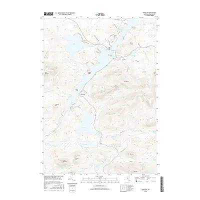
2016 Map of Deerland
USGS Topo · Published 2016About this map
Long Lake and the small community of Deerland sit at the heart of this Adirondack landscape, where the Raquette River flows north toward Buttermilk Falls. The topography is defined by significant elevations, including the prominent peaks of Mt Sabattis and Blue Mtn, alongside water bodies like Lake Eaton and S Pond. Local history is anchored by the Long Lake Cem and the Long Lake Bridge, which provides a vital crossing near Park Lake. The map details a network of secondary roads and residential ways, such as Tarbell Hill Ln and Heathfield Park, illustrating the balance between seasonal recreational access and permanent settlement. Numerous smaller ponds and brooks, including Minnow Pond and E Inlet Brook, drain the surrounding heights of Owls Head Mtn and Buck Mtn, creating a complex aquatic system that has long shaped the region's development.
Find a feature on this map
76 named features on this map. Tap any name to fly to it.
Don’t see what you’re looking for? This feature index may not catch every label — zoom into the map to look around manually.
Map Details
Editions of this 2016 Deerland Map
This is the sole edition of this map. No revisions or reprints were ever made.
Other maps of this area

1903 · Raquette Lake
USGS Topo · 1:62,500

1903 · Blue Mountain
USGS Topo · 1:62,500

1904 · Long Lake
USGS Topo · 1:62,500

1907 · Tupper Lake
USGS Topo · 1:62,500

1948 · Ogdensburg
USGS Topo · 1:250,000

1950 · Utica
USGS Topo · 1:250,000

1951 · Ogdensburg
USGS Topo · 1:250,000

1953 · Ogdensburg
USGS Topo · 1:250,000

1954 · Tupper Lake
USGS Topo · 1:62,500

1954 · Blue Mountain
USGS Topo · 1:62,500