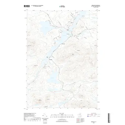
2019 Map of Deerland
USGS Topo · Published 2019About this map
Deerland and the northern reaches of Long Lake define this high-country landscape, where the Raquette River winds through narrow valleys. The settlement of Deerland serves as a central point between major water bodies like South Pond and Lake Eaton, with infrastructure including the Long Lake Bridge and a local Post Office supporting the community. Historically significant locations such as the Long Lake Cemetery and Buttermilk Falls are preserved alongside a complex network of forest roads like Tarbell Hill Lane and Newcomb Road. The area's topography is dominated by numerous peaks, including Mt Sabattis, Blue Mountain, and Owls Head Mountain, which frame a dense collection of smaller alpine waters such as Minnow Pond, Mud Pond, and Polliwog Pond.
Find a feature on this map
77 named features on this map. Tap any name to fly to it.
Don’t see what you’re looking for? This feature index may not catch every label — zoom into the map to look around manually.
Map Details
Editions of this 2019 Deerland Map
This is the sole edition of this map. No revisions or reprints were ever made.
Other maps of this area

1903 · Raquette Lake
USGS Topo · 1:62,500

1903 · Blue Mountain
USGS Topo · 1:62,500

1904 · Long Lake
USGS Topo · 1:62,500

1907 · Tupper Lake
USGS Topo · 1:62,500

1948 · Ogdensburg
USGS Topo · 1:250,000

1950 · Utica
USGS Topo · 1:250,000

1951 · Ogdensburg
USGS Topo · 1:250,000

1953 · Ogdensburg
USGS Topo · 1:250,000

1954 · Tupper Lake
USGS Topo · 1:62,500

1954 · Blue Mountain
USGS Topo · 1:62,500