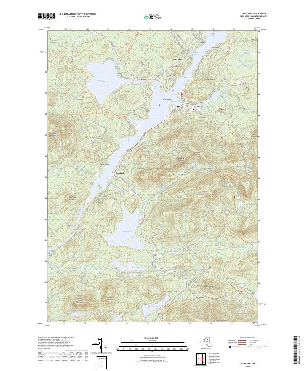
2023 Map of Deerland
USGS Topo · Published 2023About this map
The settlement of Deerland occupies the narrow passage between the expansive Long Lake and the Raquette River in this central Adirondack landscape. This area, dominated by high peaks and interconnected waterways, shows a modern infrastructure focused on recreation and preservation. The Northville-Placid Trl winds through the eastern ridges, passing beneath Mount Sabattis and Burnt Mountain, while local history is anchored at the Long Lake Cem. Numerous smaller water bodies like Polliwog Pond and Minnow Pond are tucked into the high-elevation basins.
Find a feature on this map
86 named features on this map. Tap any name to fly to it.
Don’t see what you’re looking for? This feature index may not catch every label — zoom into the map to look around manually.
Map Details
Editions of this 2023 Deerland Map
This is the sole edition of this map. No revisions or reprints were ever made.
Other maps of this area

1903 · Raquette Lake
USGS Topo · 1:62,500

1903 · Blue Mountain
USGS Topo · 1:62,500

1904 · Long Lake
USGS Topo · 1:62,500

1907 · Tupper Lake
USGS Topo · 1:62,500

1948 · Ogdensburg
USGS Topo · 1:250,000

1950 · Utica
USGS Topo · 1:250,000

1951 · Ogdensburg
USGS Topo · 1:250,000

1953 · Ogdensburg
USGS Topo · 1:250,000

1954 · Tupper Lake
USGS Topo · 1:62,500

1954 · Blue Mountain
USGS Topo · 1:62,500