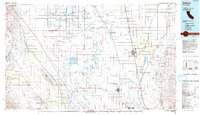
1993 Map of Delano
USGS Topo · Published 1993About this map
The Tulare Lake Bed and the Antelope Plain define the agricultural and industrial character of the southern San Joaquin Valley in this 1993 USGS study. This map documents a landscape heavily shaped by water management and resource extraction, featuring extensive networks like the Blakeley Canal and Homeland Canal alongside the Trico Gas Field and Lost Hills Oil Field. The presence of the Colonel Allensworth State Historic Park highlights a significant site of African American history, while the Kern National Wildlife Refuge and Pixley National Wildlife Refuge represent preserved segments of the valley's original ecology. Major transportation corridors, including the Southern Pacific and Atchison Topeka and Santa Fe railroads, anchor the development of regional hubs from Delano and McFarland to Wasco and Shafter.
Find a feature on this map
69 named features on this map. Tap any name to fly to it.
Don’t see what you’re looking for? This feature index may not catch every label — zoom into the map to look around manually.
Map Details
Editions of this 1993 Delano Map
2 editions found
Other maps of this area

1904 · Kaweah
USGS Topo · 1:125,000

1906 · Bakersfield
USGS Topo · 1:62,500

1909 · Kaweah
USGS Topo · 1:125,000

1910 · Buena Vista Lake
USGS Topo · 1:125,000

1912 · Coalinga
USGS Topo · 1:125,000

1912 · McKittrick
USGS Topo · 1:125,000

1912 · Buena Vista Lake
USGS Topo · 1:125,000

1914 · Caliente
USGS Topo · 1:125,000

1914 · Lost Hills
USGS Topo · 1:125,000

1914 · Cholame
USGS Topo · 1:125,000