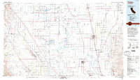
1993 Map of Delano
USGS Topo · Published 1993About this map
Colonel Allensworth State Historic Park and the vast agricultural expanses of the San Joaquin Valley define this landscape during the late twentieth century. This region is characterized by a sophisticated infrastructure of irrigation and resource extraction, notably the California Aqueduct and the extensive Trico Gas Field. The map reveals the managed hydrology of the Tulare Lake Bed and the Goose Lake Bed, where a network of levees and canals supports industrial-scale farming. Large-scale institutional land use is prominent, with the Delano State Prison and Wasco-Kern Co State Prison established alongside traditional settlements like Delano, Wasco, and Shafter. Conservation efforts are visible through the Kern National Wildlife Refuge and Pixley National Wildlife Refuge, which preserve segments of the valley's original character amidst the surrounding petroleum works of the Lost Hills Oil Field.
Find a feature on this map
93 named features on this map. Tap any name to fly to it.
Don’t see what you’re looking for? This feature index may not catch every label — zoom into the map to look around manually.
Map Details
Editions of this 1993 Delano Map
2 editions found
Other maps of this area

1904 · Kaweah
USGS Topo · 1:125,000

1906 · Bakersfield
USGS Topo · 1:62,500

1909 · Kaweah
USGS Topo · 1:125,000

1910 · Buena Vista Lake
USGS Topo · 1:125,000

1912 · Coalinga
USGS Topo · 1:125,000

1912 · McKittrick
USGS Topo · 1:125,000

1912 · Buena Vista Lake
USGS Topo · 1:125,000

1914 · Caliente
USGS Topo · 1:125,000

1914 · Lost Hills
USGS Topo · 1:125,000

1914 · Cholame
USGS Topo · 1:125,000