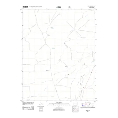
2011 Map of Delhi
USGS Topo · Published 2011About this map
Delhi and its surrounding high plains landscape are defined by a network of drainage arroyos and essential water infrastructure in this 2011 survey. The settlement is situated near the convergence of Timpas Creek and Poitrey Arroyo, a region where the survival of ranching operations depends on a series of scattered water sources. Numerous family-named landmarks such as Barbee Windmill, Deal Windmill, and Wenzel Windmill point to the persistent agricultural use of the land. Further north, the terrain is carved by Plum Canyon and Christian Canyon, while man-made improvements like Tanner Reservoir and Lyons Reservoir serve as vital collection points. The sparse road network, including County Rd 121 and Bloom Crossing Rd, connects these remote outposts across the arid Colorado plains.
Find a feature on this map
22 named features on this map. Tap any name to fly to it.
Don’t see what you’re looking for? This feature index may not catch every label — zoom into the map to look around manually.
Map Details
Editions of this 2011 Delhi Map
This is the sole edition of this map. No revisions or reprints were ever made.
Other maps of this area

1891 · Timpas
USGS Topo · 1:125,000

1891 · Apishapa
USGS Topo · 1:125,000

1893 · Apishapa
USGS Topo · 1:125,000

1894 · Timpas
USGS Topo · 1:125,000

1897 · Apishapa
USGS Topo · 1:125,000

1954 · Trinidad
USGS Topo · 1:250,000

1955 · La Junta
USGS Topo · 1:250,000

1955 · Trinidad
USGS Topo · 1:250,000

1958 · La Junta
USGS Topo · 1:250,000

1958 · Trinidad
USGS Topo · 1:250,000