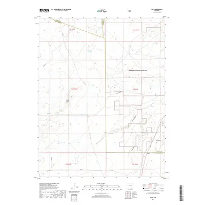
2019 Map of Delhi
USGS Topo · Published 2019About this map
Delhi serves as a lone outpost at the junction of Otero and Las Animas Counties, situated along the southeastern edge of the expansive Comanche National Grassland. This 2019 survey documents a landscape of high plains drainage, where the arid terrain is deeply carved by Poitrey Arroyo and Wild Horse Arroyo. The water management of the region is evident through the placement of Tanner Reservoir and Lyons Reservoir, critical infrastructure for livestock and land management in this dry climate.
Find a feature on this map
28 named features on this map. Tap any name to fly to it.
Don’t see what you’re looking for? This feature index may not catch every label — zoom into the map to look around manually.
Map Details
Editions of this 2019 Delhi Map
This is the sole edition of this map. No revisions or reprints were ever made.
Other maps of this area

1891 · Timpas
USGS Topo · 1:125,000

1891 · Apishapa
USGS Topo · 1:125,000

1893 · Apishapa
USGS Topo · 1:125,000

1894 · Timpas
USGS Topo · 1:125,000

1897 · Apishapa
USGS Topo · 1:125,000

1954 · Trinidad
USGS Topo · 1:250,000

1955 · La Junta
USGS Topo · 1:250,000

1955 · Trinidad
USGS Topo · 1:250,000

1958 · La Junta
USGS Topo · 1:250,000

1958 · Trinidad
USGS Topo · 1:250,000