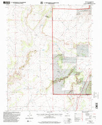
1996 Map of Delhi
USGS Topo · Published 2000About this map
Delhi sits at the junction of rail and road in the southeastern Colorado high plains, a critical waypoint in a landscape defined by water management and historic transit. The path of the Santa Fe Historic Trail cuts through the southern reaches of this terrain, following the general corridor of Timpas Creek. This 1990s revision reveals how the land is utilized for grazing within the Comanche National Grassland, supported by a network of isolated water sources like the Barbee Windmill, Wenzel Windmill, and Deal Windmill.
Find a feature on this map
26 named features on this map. Tap any name to fly to it.
Don’t see what you’re looking for? This feature index may not catch every label — zoom into the map to look around manually.
Map Details
Editions of this 1996 Delhi Map
This is the sole edition of this map. No revisions or reprints were ever made.
Other maps of this area

1891 · Timpas
USGS Topo · 1:125,000

1891 · Apishapa
USGS Topo · 1:125,000

1893 · Apishapa
USGS Topo · 1:125,000

1894 · Timpas
USGS Topo · 1:125,000

1897 · Apishapa
USGS Topo · 1:125,000

1954 · Trinidad
USGS Topo · 1:250,000

1955 · La Junta
USGS Topo · 1:250,000

1955 · Trinidad
USGS Topo · 1:250,000

1958 · La Junta
USGS Topo · 1:250,000

1958 · Trinidad
USGS Topo · 1:250,000