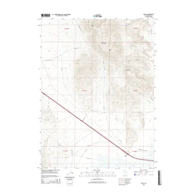
2014 Map of Delle
USGS Topo · Published 2014About this map
Delle serves as the primary outpost in this high desert landscape, situated at the base of the Lakeside Mountains. The terrain is defined by dramatic elevation changes, rising from the flat valley floor to prominent peaks like Black Mtn. Long-established transit corridors and industrial access ways dominate the map, with the Western Pacific RR Access Rd and the Marblehead Quarry Rd tracing the movements of the region's mineral and rail industries.
Find a feature on this map
28 named features on this map. Tap any name to fly to it.
Don’t see what you’re looking for? This feature index may not catch every label — zoom into the map to look around manually.
Map Details
Editions of this 2014 Delle Map
This is the sole edition of this map. No revisions or reprints were ever made.
Other maps of this area

1885 · Tooele Valley
USGS Topo · 1:250,000

1953 · Tooele
USGS Topo · 1:250,000

1955 · Timpie
USGS Topo · 1:62,500

1955 · Tooele
USGS Topo · 1:250,000

1968 · Poverty Point
USGS Topo · 1:24,000

1968 · Badger Island NW
USGS Topo · 1:24,000

1968 · Craner Peak
USGS Topo · 1:24,000

1973 · Delle
USGS Topo · 1:24,000

1973 · Hastings Pass NE
USGS Topo · 1:24,000

1973 · Low
USGS Topo · 1:24,000