
1973 Map of Hastings Pass NE
USGS Topo · Published 1977About this map
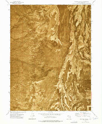
Skull Valley and its surrounding desert topography are the focus of this 1970s orthophotomap, which uses aerial photography from 1972 to reveal the stark texture of the eastern Great Basin. This specific visualization highlights the expansive Mud Flat regions that dominate the basin floor, providing a clear view of the natural drainage patterns and alkaline surfaces that characterize this part of Tooele County. Unlike traditional line-drawn maps, this format emphasizes the physical relationship between the flat valley floor and the rising terrain to the west. Evidence of human infrastructure is sparse in this environment, limited primarily to a Telephone line that cuts north-south through the valley, following the natural contour of the land. The map serves as a precise record of the desert's physical state just before the mid-1970s.
Find a feature on this map
5 named features on this map. Tap any name to fly to it.
Don’t see what you’re looking for? This feature index may not catch every label — zoom into the map to look around manually.
Map Details
Editions of this 1973 Hastings Pass NE Map
This is the sole edition of this map. No revisions or reprints were ever made.
Other maps of this area

1885 · Tooele Valley
USGS Topo · 1:250,000

1953 · Tooele
USGS Topo · 1:250,000

1955 · Timpie
USGS Topo · 1:62,500

1955 · Tooele
USGS Topo · 1:250,000

1968 · Poverty Point
USGS Topo · 1:24,000

1973 · Delle
USGS Topo · 1:24,000

1973 · Low
USGS Topo · 1:24,000

1973 · Quincy Spring
USGS Topo · 1:24,000

1973 · Hastings Pass
USGS Topo · 1:24,000
1973 · Hastings Pass SE
USGS Topo · 1:24,000