
1973 Map of Hastings Pass
USGS Topo · Published 1977About this map
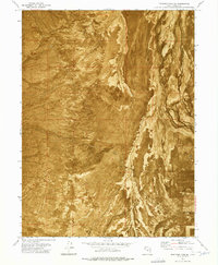
Hastings Trail winds through this arid expanse of the Cedar Mountains in Tooele County, marking a route famously used by westward emigrants. This 1970s orthophotomap provides a clear view of the mountain pass and the difficult geography that early travelers navigated. The arrival of industrial infrastructure is evident by the Western Pacific line cutting across the northern portion of the quadrangle. In the higher elevations, small-scale extraction is documented through labels for a Quarry, a Mine, and several Prospects. Vital water sources in this desert environment are specifically identified, including Redlum Spring and Henry Spring, which were essential landmarks for survival. The map captures a moment when the corridor through Hastings Pass served as both a historical corridor and a site for modern resource exploration.
Find a feature on this map
12 named features on this map. Tap any name to fly to it.
Don’t see what you’re looking for? This feature index may not catch every label — zoom into the map to look around manually.
Map Details
Editions of this 1973 Hastings Pass Map
This is the sole edition of this map. No revisions or reprints were ever made.
Other maps of this area

1885 · Tooele Valley
USGS Topo · 1:250,000

1953 · Tooele
USGS Topo · 1:250,000

1955 · Tooele
USGS Topo · 1:250,000

1973 · Ripple Valley
USGS Topo · 1:24,000

1973 · Delle
USGS Topo · 1:24,000

1973 · Hastings Pass NE
USGS Topo · 1:24,000

1973 · Low
USGS Topo · 1:24,000

1973 · Quincy Spring
USGS Topo · 1:24,000

1973 · Aragonite SE
USGS Topo · 1:24,000
1973 · Hastings Pass SE
USGS Topo · 1:24,000