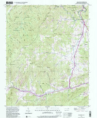
1997 Map of Dellwood
USGS Topo · Published 2001About this map
Jonathan Creek serves as the primary drainage and developmental axis for this portion of the Blue Ridge, where the valley floor transitions into the protected wilderness of the Great Smoky Mountains National Park. The landscape is defined by the Cataloochee Divide, which separates the high ridges of the park from the growing tourist and residential areas in Maggie Valley. Small mountain communities such as Suttontown and Beantown are recorded alongside family-named cemeteries including Davis Cem and Brown Cem, reflecting the deep-rooted genealogy of the region. Local institutions like Rock Hill Sch and the Olivet Ch anchor these settlements. While modern infrastructure like the Golf Course and Highway 276 appear, the map preserves the names of countless mountain peaks and gaps, from Hemphill Bald to Purchase Knob, documenting a high-altitude terrain where forestry and tourism meet.
Find a feature on this map
101 named features on this map. Tap any name to fly to it.
Don’t see what you’re looking for? This feature index may not catch every label — zoom into the map to look around manually.
Map Details
Editions of this 1997 Dellwood Map
This is the sole edition of this map. No revisions or reprints were ever made.
Other maps of this area

1891 · Cowee
USGS Topo · 1:125,000

1893 · Mt Guyot
USGS Topo · 1:125,000

1894 · Asheville
USGS Topo · 1:125,000

1897 · Cowee
USGS Topo · 1:125,000

1901 · Asheville
USGS Topo · 1:125,000

1905 · Pisgah
USGS Topo · 1:125,000

1906 · Pisgah
USGS Topo · 1:125,000

1907 · Cowee
USGS Topo · 1:125,000

1912 · Mt Guyot
USGS Topo · 1:125,000

1935 · Waynesville
USGS Topo · 1:24,000