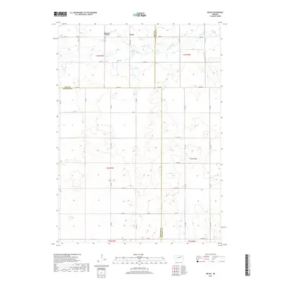
2017 Map of Deloit
USGS Topo · Published 2017About this map
Deloit and the surrounding rural landscape sit at a tri-county junction where Holt, Antelope, and Wheeler counties meet. This 2017 survey details a high-plains agricultural environment defined by its section-line road network, including 848th Rd and 508th Ave, which connect isolated homesteads and family holdings. Significant local landmarks like Wolf Cem and Park Church serve as vital anchor points for genealogists tracing the legacy of early settlers in this portion of the Sandhills region.
Find a feature on this map
39 named features on this map. Tap any name to fly to it.
Don’t see what you’re looking for? This feature index may not catch every label — zoom into the map to look around manually.
Map Details
Editions of this 2017 Deloit Map
This is the sole edition of this map. No revisions or reprints were ever made.
Other maps of this area

1955 · Broken Bow
USGS Topo · 1:250,000

1955 · O'Neill
USGS Topo · 1:250,000

1956 · Broken Bow
USGS Topo · 1:250,000

1959 · O'Neill
USGS Topo · 1:250,000

1960 · Spalding 2 NW
USGS Topo · 1:24,000

1960 · Spalding 2 NE
USGS Topo · 1:24,000

1963 · Deloit
USGS Topo · 1:24,000

1963 · Deloit SW
USGS Topo · 1:24,000

1963 · Neligh SW
USGS Topo · 1:24,000

1963 · Elgin NW
USGS Topo · 1:24,000