
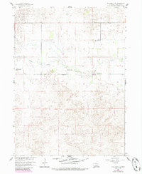
1960 Map of Spalding 2 NW
USGS Topo · Published 1961About this map
Beaver Creek winds through this section of the Nebraska Sandhills, marking a landscape of wide valleys and dispersed cattle ranching at the dawn of the 1960s. The map illustrates a rural settlement pattern where life is organized around major family-held lands such as Stokes Ranch, Mignery Ranch, and Koinzan Ranch. These established operations define the social and economic geography of Caldwell and Bartlett townships, where vast stretches of terrain are punctuated by the essential infrastructure of remote prairie living. A single educational landmark, Wayside Sch, stands near the creek, serving as a focal point for the surrounding ranching families. This survey, part of the development program for the Missouri River Basin, provides a precise record of the road networks and water sources that sustained these isolated operations before further modernization changed the face of Wheeler County agriculture.
Find a feature on this map
9 named features on this map. Tap any name to fly to it.
Don’t see what you’re looking for? This feature index may not catch every label — zoom into the map to look around manually.
Map Details
Editions of this 1960 Spalding 2 NW Map
3 editions found
Other maps of this area

1954 · Bartlett SE
USGS Topo · 1:24,000

1954 · Bartlett
USGS Topo · 1:24,000

1955 · Broken Bow
USGS Topo · 1:250,000

1955 · O'Neill
USGS Topo · 1:250,000

1956 · Broken Bow
USGS Topo · 1:250,000

1959 · O'Neill
USGS Topo · 1:250,000

1960 · Spalding 2 SW
USGS Topo · 1:24,000

1960 · Spalding 2 NE
USGS Topo · 1:24,000

1960 · Spalding 2 SE
USGS Topo · 1:24,000

1963 · Deloit
USGS Topo · 1:24,000