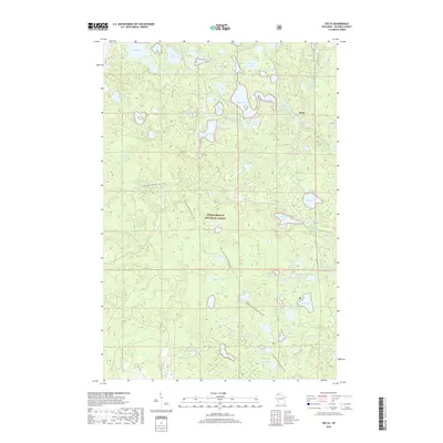
2018 Map of Delta
USGS Topo · Published 2018About this map
Delta is the primary settlement on this northern Wisconsin map, situated amidst a dense network of glacial lakes and wetlands. The landscape is dominated by the Chequamegon National Forest, where the complex hydrology includes the headwaters of the W Fork White River and the E Fork White River. This 2018 survey reveals a terrain defined by kettle lakes and moraines, with notable bodies of water like Lake Delta, Phantom Lake, and Spirit Lake clustered near the town. For outdoor historians and land managers, the inclusion of the N Country National Scenic Trail provides a detailed record of modern recreational infrastructure through the forest. The map also documents the localized road network, featuring Co Hwy H and several forest-access routes like Camp One Rd that connect the scattered lakefront properties and timberlands.
Find a feature on this map
64 named features on this map. Tap any name to fly to it.
Don’t see what you’re looking for? This feature index may not catch every label — zoom into the map to look around manually.
Map Details
Editions of this 2018 Delta Map
This is the sole edition of this map. No revisions or reprints were ever made.
Other maps of this area

1943 · Iron Lake
USGS Topo · 1:48,000

1944 · Moquah
USGS Topo · 1:48,000

1944 · Drummond
USGS Topo · 1:48,000

1944 · Grandview
USGS Topo · 1:48,000

1947 · Drummond
USGS Topo · 1:48,000

1947 · Moquah
USGS Topo · 1:48,000

1947 · Iron Lake
USGS Topo · 1:48,000

1947 · Grandview
USGS Topo · 1:48,000

1953 · Ashland
USGS Topo · 1:250,000

1958 · Ashland
USGS Topo · 1:250,000