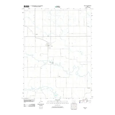
2010 Map of Delta
USGS Topo · Published 2010About this map
The North Skunk River meanders across this rural landscape, joined by its southern counterpart and numerous smaller tributaries like Cedar Creek and Coal Creek. The settlement of Delta serves as the local hub, marked by the Delta Post Office and the notable Delta Covered Bridge spanning the river to the south. This area of Keokuk County is defined by its deep agricultural roots and a grid of secondary roads that connect outlying communities like Springfield, Hayesville, and Divide. For genealogists and local historians, several burial sites are clearly documented, including Springfield Cemetery, Garrett Cemetery, Kensler Cemetery, and Bethel Cemetery. The topography reveals the intricate drainage patterns that have shaped farming and settlement in this portion of southeast Iowa for generations.
Find a feature on this map
47 named features on this map. Tap any name to fly to it.
Don’t see what you’re looking for? This feature index may not catch every label — zoom into the map to look around manually.
Map Details
Editions of this 2010 Delta Map
This is the sole edition of this map. No revisions or reprints were ever made.
Other maps of this area

1954 · Des Moines
USGS Topo · 1:250,000

1956 · Des Moines
USGS Topo · 1:250,000

1956 · Ottumwa North
USGS Topo · 1:62,500

1957 · Des Moines
USGS Topo · 1:250,000

1965 · Gibson
USGS Topo · 1:24,000

1965 · Rose Hill
USGS Topo · 1:24,000

1965 · What Cheer
USGS Topo · 1:24,000

1965 · Keswick
USGS Topo · 1:24,000

1965 · Sigourney
USGS Topo · 1:24,000

1965 · Delta
USGS Topo · 1:24,000