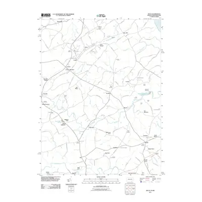
2011 Map of Delta
USGS Topo · Published 2011About this map
The Pennsylvania-Maryland border defines the character of this landscape, where the towns of Delta and Cardiff sit directly adjacent to one another across the state line. This area reflects a deep history of quarrying, evident by the Funkhouse Quarry and various roads named for the industry, such as Quarry Rd and Slate Ridge Rd. The northern portion of the map is dominated by these industrial roots and small settlements like West Bangor and Ailston, while the southern Maryland side transitions into a more rural, camp-heavy environment. Large recreational and institutional tracts like the Broad Creek Memorial Scout Camp and several smaller camps such as Camp Saffran and Camp Oest cluster near Broad Creek. Numerous local burying grounds, including Slate Ridge Cemetery and Zion Cemetery, provide significant points of interest for those tracing family lineages in this border region.
Find a feature on this map
154 named features on this map. Tap any name to fly to it.
Don’t see what you’re looking for? This feature index may not catch every label — zoom into the map to look around manually.
Map Details
Editions of this 2011 Delta Map
This is the sole edition of this map. No revisions or reprints were ever made.
Other maps of this area

1900 · Havre De Grace
USGS Topo · 1:62,500

1901 · Belair
USGS Topo · 1:62,500

1912 · Quarryville
USGS Topo · 1:62,500

1912 · Mc Calls Ferry
USGS Topo · 1:62,500

1942 · Havre De Grace
USGS Topo · 1:62,500

1942 · Bel Air
USGS Topo · 1:62,500

1943 · Quarryville
USGS Topo · 1:62,500

1943 · Mc Calls Ferry
USGS Topo · 1:62,500

1945 · Bel Air
USGS Topo · 1:62,500

1948 · Baltimore
USGS Topo · 1:250,000