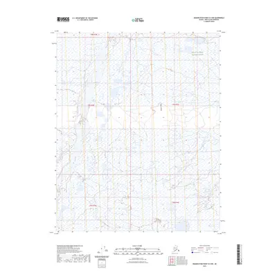
2023 Map of Demarcation Point D-4 NW
USGS Topo · Published 2023About this map
Arctic National Wildlife Refuge encompasses the entirety of this remote northern landscape, where the braided channels of the Jago River dominate the western terrain. The river flows northward toward the coast, cutting a path through a vast expanse of wetlands and tundra. To the east, the elevation rises slightly at Niguanak Ridge, a subtle geographic landmark in an otherwise low-lying environment of numerous unnamed ponds and drainage basins. This 2023 survey illustrates the complex hydrography of the North Slope, capturing a moment in the shifting natural history of a protected wilderness area defined by seasonal water cycles and untouched topography.
Find a feature on this map
8 named features on this map. Tap any name to fly to it.
Don’t see what you’re looking for? This feature index may not catch every label — zoom into the map to look around manually.
Map Details
Editions of this 2023 Demarcation Point D-4 NW Map
This is the sole edition of this map. No revisions or reprints were ever made.
Other maps of this area

1951 · Barter Island
USGS Topo · 1:250,000

1951 · Demarcation Point
USGS Topo · 1:250,000

1955 · Demarcation Point
USGS Topo · 1:250,000

1955 · Barter Island A-5
USGS Topo · 1:63,360

1955 · Barter Island A-4
USGS Topo · 1:63,360

1955 · Demarcation Point D-5
USGS Topo · 1:63,360

1955 · Demarcation Point D-4
USGS Topo · 1:63,360

1959 · Barter Island
USGS Topo · 1:250,000

1964 · Demarcation Point
USGS Topo · 1:250,000
1964 · Barter Island
USGS Topo · 1:250,000