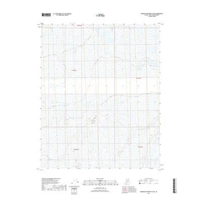
2018 Map of Demarcation Point D-5 NE
USGS Topo · Published 2018About this map
Jago River winds through this northern landscape, representing the primary drainage for this section of the Arctic coastal plain. The terrain is defined by a dense network of wetlands and thaw lakes typical of the North Slope's permafrost environment, where water dominates the land-use patterns. Unlike the industrial corridors found elsewhere in the region, this 2018 survey reveals an area primarily characterized by its natural hydrological features and the absence of established road networks or permanent settlements. The administrative divisions of t8n r34e, t7n r34e, and t6n r35e provide the structural framework for this remote corner of the North Slope Borough, illustrating how the Public Land Survey System is applied to even the most isolated northern territories.
Find a feature on this map
6 named features on this map. Tap any name to fly to it.
Don’t see what you’re looking for? This feature index may not catch every label — zoom into the map to look around manually.
Map Details
Editions of this 2018 Demarcation Point D-5 NE Map
This is the sole edition of this map. No revisions or reprints were ever made.
Other maps of this area

1951 · Barter Island
USGS Topo · 1:250,000

1951 · Demarcation Point
USGS Topo · 1:250,000

1955 · Demarcation Point
USGS Topo · 1:250,000

1955 · Barter Island A-5
USGS Topo · 1:63,360

1955 · Barter Island A-4
USGS Topo · 1:63,360

1955 · Demarcation Point D-5
USGS Topo · 1:63,360

1955 · Demarcation Point D-4
USGS Topo · 1:63,360

1959 · Barter Island
USGS Topo · 1:250,000

1964 · Demarcation Point
USGS Topo · 1:250,000
1964 · Barter Island
USGS Topo · 1:250,000