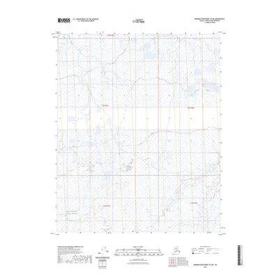
2023 Map of Demarcation Point D-5 NE
USGS Topo · Published 2023About this map
Arctic National Wildlife Refuge encompasses the southwestern portion of this map, signifying the preservation of a landscape defined by expansive wetlands and hydrographic systems. This 2023 survey illustrates a wilderness where the land is primarily delineated by the Public Land Survey System, specifically within the townships of t8n r34e, t7n r34e, and t7n r35e. The absence of roads or established settlements emphasizes the remote character of this region in the North Slope Borough, where the intricate network of water bodies and marshlands serves as the primary geographic markers. For those studying the environmental management of northern Alaska, the map provides precise section lines and township boundaries essential for understanding the administrative structure of these protected lands.
Find a feature on this map
6 named features on this map. Tap any name to fly to it.
Don’t see what you’re looking for? This feature index may not catch every label — zoom into the map to look around manually.
Map Details
Editions of this 2023 Demarcation Point D-5 NE Map
This is the sole edition of this map. No revisions or reprints were ever made.
Other maps of this area

1951 · Barter Island
USGS Topo · 1:250,000

1951 · Demarcation Point
USGS Topo · 1:250,000

1955 · Demarcation Point
USGS Topo · 1:250,000

1955 · Barter Island A-5
USGS Topo · 1:63,360

1955 · Barter Island A-4
USGS Topo · 1:63,360

1955 · Demarcation Point D-5
USGS Topo · 1:63,360

1955 · Demarcation Point D-4
USGS Topo · 1:63,360

1959 · Barter Island
USGS Topo · 1:250,000

1964 · Demarcation Point
USGS Topo · 1:250,000
1964 · Barter Island
USGS Topo · 1:250,000