
1967 Map of Denby
USGS Topo · Published 1970About this map
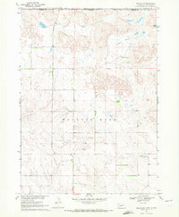
Wounded Knee Creek winds through this landscape on the Pine Ridge Indian Reservation Boundary, illustrating a late 1960s snapshot of the South Dakota and Nebraska borderlands. The small settlement of Denby serves as a local focal point near the intersection of various water features and transportation routes. Notable for genealogists and local historians, the map identifies a Native American Cem situated west of the creek, providing a specific location for cultural and ancestral research.
Find a feature on this map
14 named features on this map. Tap any name to fly to it.
Don’t see what you’re looking for? This feature index may not catch every label — zoom into the map to look around manually.
Map Details
Editions of this 1967 Denby Map
This is the sole edition of this map. No revisions or reprints were ever made.
Other maps of this area

1955 · Hot Springs
USGS Topo · 1:250,000

1955 · Alliance
USGS Topo · 1:250,000

1957 · Alliance
USGS Topo · 1:250,000

1958 · Alliance
USGS Topo · 1:250,000

1967 · Manderson
USGS Topo · 1:24,000

1967 · Manderson SW
USGS Topo · 1:24,000

1967 · Wounded Knee
USGS Topo · 1:24,000

1969 · Clinton NW
USGS Topo · 1:24,000

1969 · Clinton NE
USGS Topo · 1:24,000
1969 · Gordon NW
USGS Topo · 1:24,000