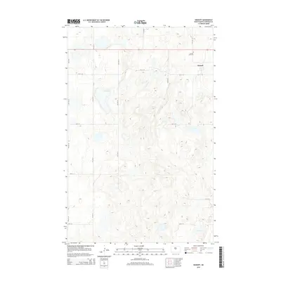
2014 Map of Denhoff
USGS Topo · Published 2014About this map
Denhoff serves as the primary settlement on this Sheridan County prairie landscape, appearing in this 2014 survey as a grid of named streets including Main St E and 1st St SE. The terrain is characterized by the numerous small depressions and seasonal wetlands typical of the Missouri Coteau region, with North Lake situated in the southeast corner. Local history and genealogy are anchored by the Denhoff Cemeteries north of the main townsite. The layout of the region is defined by a strict section-line road network, such as 8th Ave SE and 9th Ave NE, which organize the agricultural land surrounding the central village. This map documents the persistent rural structure of central North Dakota, highlighting the interface between the modest residential footprint of Denhoff and the expansive, pothole-dotted plains.
Find a feature on this map
16 named features on this map. Tap any name to fly to it.
Don’t see what you’re looking for? This feature index may not catch every label — zoom into the map to look around manually.
Map Details
Editions of this 2014 Denhoff Map
This is the sole edition of this map. No revisions or reprints were ever made.
Other maps of this area

1946 · Sheyenne Lake
USGS Topo · 1:48,000

1947 · Lincoln Valley
USGS Topo · 1:62,500

1947 · Sheyenne Lake
USGS Topo · 1:62,500

1954 · McClusky
USGS Topo · 1:250,000

1958 · McClusky
USGS Topo · 1:250,000

1959 · McClusky
USGS Topo · 1:24,000

1960 · Lincoln Valley SE
USGS Topo · 1:24,000

1960 · Horse Lake
USGS Topo · 1:24,000

1960 · Florence Lake
USGS Topo · 1:24,000

1960 · Denhoff
USGS Topo · 1:24,000