
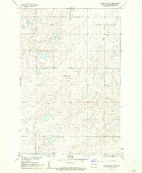
1960 Map of Denhoff
USGS Topo · Published 1961About this map
Denhoff serves as the primary hub in this central North Dakota landscape, situated along the Northern Pacific railroad line. The map reveals a quintessential prairie settlement pattern during the mid-century, where the town site is supported by a network of rural schoolhouses distributed across the townships, including School No 1, School No 2, and School No 3. A more specifically named institution, Whittaker Sch No 2, suggests the influence of local families on the district's geography.
Find a feature on this map
11 named features on this map. Tap any name to fly to it.
Don’t see what you’re looking for? This feature index may not catch every label — zoom into the map to look around manually.
Map Details
Editions of this 1960 Denhoff Map
This is the sole edition of this map. No revisions or reprints were ever made.
Other maps of this area

1946 · Sheyenne Lake
USGS Topo · 1:48,000

1947 · Lincoln Valley
USGS Topo · 1:62,500

1947 · Sheyenne Lake
USGS Topo · 1:62,500

1954 · McClusky
USGS Topo · 1:250,000

1958 · McClusky
USGS Topo · 1:250,000

1959 · McClusky
USGS Topo · 1:24,000

1960 · Lincoln Valley SE
USGS Topo · 1:24,000

1960 · Horse Lake
USGS Topo · 1:24,000

1960 · Florence Lake
USGS Topo · 1:24,000
1960 · Lincoln Valley SW
USGS Topo · 1:24,000