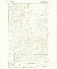
1960 Map of Lincoln Valley SW
USGS Topo · Published 1962About this map
Sheridan County prairie life is centered around a network of rural schools and churches in this 1960s study of the Lincoln Dale and McClusky townships. The landscape is defined by its scattered educational houses, including Herr Sch No 1, Mountain City Sch No 1, and Hellman Sch No 2, which reveal the high density of small-district schoolhouses still present before mid-century consolidation fully reshaped North Dakota's rural districts.
Find a feature on this map
9 named features on this map. Tap any name to fly to it.
Don’t see what you’re looking for? This feature index may not catch every label — zoom into the map to look around manually.
Map Details
Editions of this 1960 Lincoln Valley SW Map
2 editions found
Other maps of this area

1945 · Pelican Lake
USGS Topo · 1:62,500

1947 · Pelican Lake
USGS Topo · 1:62,500

1947 · Lincoln Valley
USGS Topo · 1:62,500

1954 · McClusky
USGS Topo · 1:250,000

1958 · McClusky
USGS Topo · 1:250,000

1959 · Pickardville
USGS Topo · 1:24,000

1959 · McClusky
USGS Topo · 1:24,000

1960 · Lincoln Valley SE
USGS Topo · 1:24,000

1960 · Denhoff
USGS Topo · 1:24,000
1960 · Lincoln Valley
USGS Topo · 1:24,000