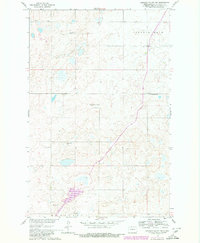
1960 Map of Lincoln Valley SW
USGS Topo · Published 1980About this map
Isolated schools and farm-to-market roads define this Sheridan County landscape as it appeared during the development of the Missouri River Basin project. The map illustrates a rural educational network including Herr Sch No 1, Mountain City Sch No 1, and Hellman Sch No 2, serving the townships of Lincoln Dale and McClusky. These rural hubs provided essential community structure in a region dominated by prairie depressions and small sloughs.
Find a feature on this map
10 named features on this map. Tap any name to fly to it.
Don’t see what you’re looking for? This feature index may not catch every label — zoom into the map to look around manually.
Map Details
Editions of this 1960 Lincoln Valley SW Map
2 editions found
Other maps of this area

1945 · Pelican Lake
USGS Topo · 1:62,500

1947 · Pelican Lake
USGS Topo · 1:62,500

1947 · Lincoln Valley
USGS Topo · 1:62,500

1954 · McClusky
USGS Topo · 1:250,000

1958 · McClusky
USGS Topo · 1:250,000

1959 · Pickardville
USGS Topo · 1:24,000

1959 · McClusky
USGS Topo · 1:24,000

1960 · Lincoln Valley SE
USGS Topo · 1:24,000

1960 · Denhoff
USGS Topo · 1:24,000
1960 · Lincoln Valley
USGS Topo · 1:24,000