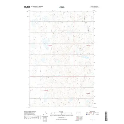
2017 Map of Denhoff
USGS Topo · Published 2017About this map
The small prairie community of Denhoff serves as the focal point for this Sheridan County landscape, characterized by the traditional Jeffersonian grid of section lines and gravel township roads. In the northeastern corner of the map, the Denhoff Catholic Cem stands as a significant landmark for genealogists and local historians, situated just outside the primary residential cluster. The surrounding terrain is defined by numerous small depressions and potholes, common to this region of North Dakota, including the prominent N Lake to the southeast. A network of numbered local routes like 5th St NE and 9th Ave NE provides access to the agricultural tracts of t146n r76w and t146n r75w, reflecting the enduring rural character of the area in the twenty-first century.
Find a feature on this map
22 named features on this map. Tap any name to fly to it.
Don’t see what you’re looking for? This feature index may not catch every label — zoom into the map to look around manually.
Map Details
Editions of this 2017 Denhoff Map
This is the sole edition of this map. No revisions or reprints were ever made.
Other maps of this area

1946 · Sheyenne Lake
USGS Topo · 1:48,000

1947 · Lincoln Valley
USGS Topo · 1:62,500

1947 · Sheyenne Lake
USGS Topo · 1:62,500

1954 · McClusky
USGS Topo · 1:250,000

1958 · McClusky
USGS Topo · 1:250,000

1959 · McClusky
USGS Topo · 1:24,000

1960 · Lincoln Valley SE
USGS Topo · 1:24,000

1960 · Horse Lake
USGS Topo · 1:24,000

1960 · Florence Lake
USGS Topo · 1:24,000

1960 · Denhoff
USGS Topo · 1:24,000