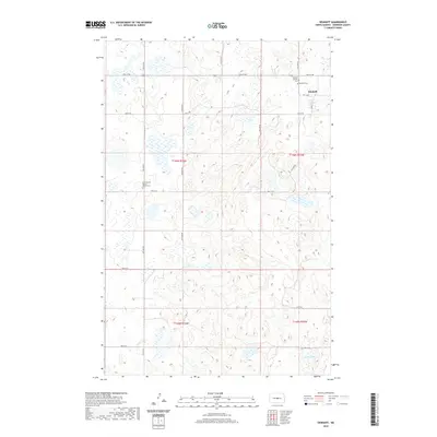
2020 Map of Denhoff
USGS Topo · Published 2020About this map
Denhoff serves as the central hub of this Sheridan County landscape, where the prairie is defined by a complex network of glacial depressions and small wetlands. The town's religious and community history is anchored by several sites of interment, including the Denhoff Catholic Cemetery and the Denhoff Cemetery just to the south. Further west, the First German Baptist Church Cem sits along 2nd St NE, providing a genealogical focal point for families of the area’s early settlers. The terrain is characterized by numerous unnamed prairie potholes, typical of the Missouri Coteau region, with North Lake standing out as a primary water body in the southeastern portion of the quadrangle. A strictly rectangular grid of section lines and local roads like 5th St NE and Main St E organizes the agricultural homesteads across the townships.
Find a feature on this map
18 named features on this map. Tap any name to fly to it.
Don’t see what you’re looking for? This feature index may not catch every label — zoom into the map to look around manually.
Map Details
Editions of this 2020 Denhoff Map
This is the sole edition of this map. No revisions or reprints were ever made.
Other maps of this area

1946 · Sheyenne Lake
USGS Topo · 1:48,000

1947 · Lincoln Valley
USGS Topo · 1:62,500

1947 · Sheyenne Lake
USGS Topo · 1:62,500

1954 · McClusky
USGS Topo · 1:250,000

1958 · McClusky
USGS Topo · 1:250,000

1959 · McClusky
USGS Topo · 1:24,000

1960 · Lincoln Valley SE
USGS Topo · 1:24,000

1960 · Horse Lake
USGS Topo · 1:24,000

1960 · Florence Lake
USGS Topo · 1:24,000

1960 · Denhoff
USGS Topo · 1:24,000