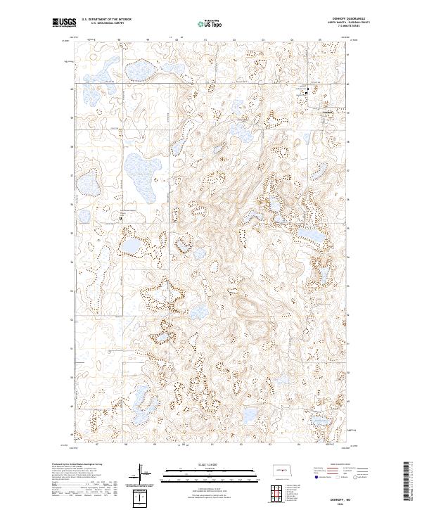
2024 Map of Denhoff
USGS Topo · Published 2024About this map
Denhoff and the surrounding Sheridan County plains are defined by a rhythmic grid of rural roads and scattered prairie wetlands. This landscape is historically anchored by faith and memory, visible in the cluster of sacred sites such as the First German Baptist Church and its adjacent First German Baptist Cem. These locations, along with the Denhoff Cem and Denhoff Catholic Cem, serve as vital touchpoints for genealogists tracing the legacy of early German-settler communities in the region. The map reflects a dedicated balance between agriculture and conservation, with several blocks of the Sheridan County Waterfowl Production Area preserved among the townships. To the south, the waters of North Lake provide a rare larger hydrographic feature amidst the numerous smaller potholes and depressions that characterize this stretch of the northern prairie.
Find a feature on this map
27 named features on this map. Tap any name to fly to it.
Don’t see what you’re looking for? This feature index may not catch every label — zoom into the map to look around manually.
Map Details
Editions of this 2024 Denhoff Map
This is the sole edition of this map. No revisions or reprints were ever made.
Other maps of this area

1946 · Sheyenne Lake
USGS Topo · 1:48,000

1947 · Lincoln Valley
USGS Topo · 1:62,500

1947 · Sheyenne Lake
USGS Topo · 1:62,500

1954 · McClusky
USGS Topo · 1:250,000

1958 · McClusky
USGS Topo · 1:250,000

1959 · McClusky
USGS Topo · 1:24,000

1960 · Lincoln Valley SE
USGS Topo · 1:24,000

1960 · Horse Lake
USGS Topo · 1:24,000

1960 · Florence Lake
USGS Topo · 1:24,000

1960 · Denhoff
USGS Topo · 1:24,000