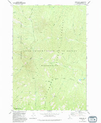
1991 Map of Dennis Mtn
USGS Topo · Published 1994About this map
Dennis Mtn and the surrounding high ridges of the Frank Church-River of No Return Wilderness dominate this high-altitude landscape in the early 1990s. This territory, situated within the Nezperce National Forest and Bitterroot National Forest, is defined by a dense network of watercourses and steep divides, including Sabe Creek, Harrington Ridge, and Bitterroot Ridge. The lack of modern roads emphasizes the area's protected status, with movement limited to a Pack Trail that connects remote points like Black Creek Saddle and Harrington Saddle. Local landmarks such as Cabin Spring and the Dennis Lakes suggest the essential role of water sources for those navigating these summits. To the south, the Salmon Wild and Scenic River forms a significant boundary, marking the transition from the high ridges like Smith Ridge to the deep river corridor.
Find a feature on this map
39 named features on this map. Tap any name to fly to it.
Don’t see what you’re looking for? This feature index may not catch every label — zoom into the map to look around manually.
Map Details
Editions of this 1991 Dennis Mtn Map
This is the sole edition of this map. No revisions or reprints were ever made.
Other maps of this area

1956 · Elk City
USGS Topo · 1:250,000

1960 · Elk City
USGS Topo · 1:250,000

1978 · Waugh Mountain
USGS Topo · 1:24,000

1978 · Arctic Point
USGS Topo · 1:24,000

1978 · Spread Creek Point
USGS Topo · 1:24,000

1978 · Dennis Mtn
USGS Topo · 1:24,000

1978 · Magruder Mtn
USGS Topo · 1:24,000

1978 · Sheep Hill
USGS Topo · 1:24,000

1978 · Devils Teeth Rapids
USGS Topo · 1:24,000
1979 · Sabe Mtn
USGS Topo · 1:24,000