
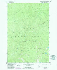
1978 Map of Spread Creek Point
USGS Topo · Published 1978About this map
Nez Perce National Forest dominates this mountain landscape in Idaho County, where the topography transitions into the Salmon River Breaks. The map details a wilderness defined by its drainage systems and high ridges, including Elk Mountain and Spread Creek Point. The region is managed as part of the Salmon River Breaks Primitive Area, ensuring the preservation of the remote character of Bargamin Creek and Spread Creek.
Find a feature on this map
30 named features on this map. Tap any name to fly to it.
Don’t see what you’re looking for? This feature index may not catch every label — zoom into the map to look around manually.
Map Details
Editions of this 1978 Spread Creek Point Map
2 editions found
Other maps of this area

1956 · Elk City
USGS Topo · 1:250,000

1960 · Elk City
USGS Topo · 1:250,000

1966 · Green Mtn.
USGS Topo · 1:24,000

1966 · Three Prong Mountain
USGS Topo · 1:24,000

1966 · Sable Hill
USGS Topo · 1:24,000

1977 · Boston Mtn
USGS Topo · 1:24,000

1978 · Dennis Mtn
USGS Topo · 1:24,000

1978 · Hida Point
USGS Topo · 1:24,000

1978 · Sheep Hill
USGS Topo · 1:24,000
1979 · Sabe Mtn
USGS Topo · 1:24,000