
1966 Map of Sable Hill
USGS Topo · Published 1968About this map
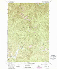
Red River Hot Springs serves as a remote destination within this section of the Nez Perce National Forest, where thermal activity meets the cold waters of the Red River. The landscape in the mid-1960s is defined by a dense network of drainages such as Sable Creek, Shissler Creek, and Meadow Creek that carve through prominent high ground including Sable Hill and Simmons Ridge. Unlike more developed areas, the human imprint here is limited to essential backcountry infrastructure, notably a Campground and the survey marker Uslm 228. Transportation is almost entirely restricted to a web of Pack Trails and Jeep Trails, illustrating the era's reliance on primitive access for forest management and recreation. The topographic detail captures the steep transition from the river bottom to landmarks like Tamarack Saddle and Matteson Ridge.
Find a feature on this map
25 named features on this map. Tap any name to fly to it.
Don’t see what you’re looking for? This feature index may not catch every label — zoom into the map to look around manually.
Map Details
Editions of this 1966 Sable Hill Map
2 editions found
Other maps of this area

1956 · Elk City
USGS Topo · 1:250,000

1960 · Elk City
USGS Topo · 1:250,000

1966 · Green Mtn.
USGS Topo · 1:24,000

1966 · Black Hawk Mtn
USGS Topo · 1:24,000

1966 · Anderson Butte
USGS Topo · 1:24,000
1966 · Running Lake
USGS Topo · 1:24,000
1966 · Vermilion Peak
USGS Topo · 1:24,000

1977 · Boston Mtn
USGS Topo · 1:24,000

1978 · Spread Creek Point
USGS Topo · 1:24,000

1978 · Trapper Creek
USGS Topo · 1:24,000