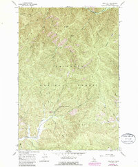
1966 Map of Sable Hill
USGS Topo · Published 1987About this map
Red River Hot Springs serves as a primary landmark in this remote section of the Nez Perce National Forest. The landscape is defined by a dense network of historic travel routes, including the Simmons Ridge Pack Trail and Sable Creek Pack Trail, which follow high ridgelines and creek beds. These pack trails represent the primary infrastructure of the era, connecting geographic features like Sable Hill and Tamarack Saddle before the expansion of modern road systems. The convergence of the East Fork Red River with numerous tributaries such as Shissler Creek and Bridge Creek highlights the complex drainage patterns of the region. Local recreational use is evident near the Bridge Creek Campground, providing a specific point of interest for those tracking land use and wilderness development in Idaho County during the mid-1960s.
Find a feature on this map
25 named features on this map. Tap any name to fly to it.
Don’t see what you’re looking for? This feature index may not catch every label — zoom into the map to look around manually.
Map Details
Editions of this 1966 Sable Hill Map
2 editions found
Other maps of this area

1956 · Elk City
USGS Topo · 1:250,000

1960 · Elk City
USGS Topo · 1:250,000

1966 · Green Mtn.
USGS Topo · 1:24,000

1966 · Black Hawk Mtn
USGS Topo · 1:24,000

1966 · Sable Hill
USGS Topo · 1:24,000

1966 · Anderson Butte
USGS Topo · 1:24,000
1966 · Running Lake
USGS Topo · 1:24,000
1966 · Vermilion Peak
USGS Topo · 1:24,000

1977 · Boston Mtn
USGS Topo · 1:24,000

1978 · Spread Creek Point
USGS Topo · 1:24,000