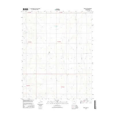
2016 Map of Denny Lake
USGS Topo · Published 2016About this map
Little Kansas Cem sits centrally within this high plains landscape of Bent County, marking a site of local genealogical interest in an area otherwise defined by ephemeral watercourses and section roads. The terrain is shaped by a complex network of drainage, including the winding Mud Cr in the northwest and Rattlesnake Cr along the southern boundary. Small, vital water sources like Toe Jam Spring and the namesake Denny Lake punctuate the arid environment. A grid of county roads, such as Co RD 34 and Co RD W, facilitates movement across the township and range lines, connecting these isolated water features and landmarks within the ranching and agricultural landscape of eastern Colorado.
Find a feature on this map
21 named features on this map. Tap any name to fly to it.
Don’t see what you’re looking for? This feature index may not catch every label — zoom into the map to look around manually.
Map Details
Editions of this 2016 Denny Lake Map
This is the sole edition of this map. No revisions or reprints were ever made.
Other maps of this area

1892 · Lamar
USGS Topo · 1:125,000

1892 · Two Butte
USGS Topo · 1:125,000

1893 · Two Butte
USGS Topo · 1:125,000

1952 · Lamar West
USGS Topo · 1:24,000

1953 · Hasty
USGS Topo · 1:24,000

1953 · Prowers
USGS Topo · 1:24,000

1954 · Lamar
USGS Topo · 1:250,000

1955 · La Junta
USGS Topo · 1:250,000

1958 · La Junta
USGS Topo · 1:250,000

1958 · Lamar
USGS Topo · 1:250,000