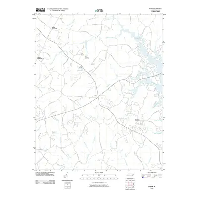
2010 Map of Denver
USGS Topo · Published 2010About this map
Denver serves as a primary hub in this eastern Catawba County landscape, situated near the expanding shoreline of Lake Norman. The area is characterized by several historic junction points, including Drums Crossroads, Olivers Crossroads, and Killian Crossroads, which anchor the local road network. Natural elevation is dominated by Anderson Mountain, while the hydrology is defined by numerous creek systems such as Ballard Creek, Killian Creek, and Forney Creek. Small-scale aviation and recreation are evident through features like Little Mountain Airport, Lanneys Airport, and the Rock Springs Campground. The map also captures several private water bodies and infrastructure markers, including Jones Lake and the Quinlen Lake Dam Reservoir. This survey highlights the transition of the region as residential development and lakeside recreation sites like Camp Dogwood interface with the traditional rural crossroads and agricultural land.
Find a feature on this map
82 named features on this map. Tap any name to fly to it.
Don’t see what you’re looking for? This feature index may not catch every label — zoom into the map to look around manually.
Map Details
Editions of this 2010 Denver Map
This is the sole edition of this map. No revisions or reprints were ever made.
Other maps of this area

1893 · Statesville
USGS Topo · 1:125,000

1895 · Hickory
USGS Topo · 1:125,000

1914 · Gastonia
USGS Topo · 1:48,000

1916 · Gastonia
USGS Topo · 1:62,500

1941 · Charlotte
USGS Topo · 1:125,000

1942 · Charlotte
USGS Topo · 1:125,000

1949 · Hicks Crossroads
USGS Topo · 1:24,000

1953 · Charlotte
USGS Topo · 1:250,000

1954 · Charlotte
USGS Topo · 1:250,000

1960 · Charlotte
USGS Topo · 1:250,000