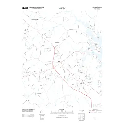
2013 Map of Denver
USGS Topo · Published 2013About this map
Denver and the surrounding Catawba County landscape are defined by the expansive eastern shoreline of Lake Norman and a series of historic road junctions. The terrain is characterized by prominent elevations such as Anderson Mountain and several small aviation facilities, including Little Mountain Airport and Laneys Airport. Traditional settlement patterns are visible at Drums Crossroads, Olivers Crossroads, and Killian Crossroads, where local road networks converge near watercourses like S Fork Mountain Cr and Reed Cr. The map captures the suburban growth and recreation-focused development near the lake's edge, contrasting with the more rural interior marked by features like Rock Springs and the headwaters of Forney Cr. Significant drainage systems, including Killian Cr and Balls Cr, illustrate the complex hydrology feeding into the larger reservoir system.
Find a feature on this map
219 named features on this map. Tap any name to fly to it.
Don’t see what you’re looking for? This feature index may not catch every label — zoom into the map to look around manually.
Map Details
Editions of this 2013 Denver Map
This is the sole edition of this map. No revisions or reprints were ever made.
Other maps of this area

1893 · Statesville
USGS Topo · 1:125,000

1895 · Hickory
USGS Topo · 1:125,000

1914 · Gastonia
USGS Topo · 1:48,000

1916 · Gastonia
USGS Topo · 1:62,500

1941 · Charlotte
USGS Topo · 1:125,000

1942 · Charlotte
USGS Topo · 1:125,000

1949 · Hicks Crossroads
USGS Topo · 1:24,000

1953 · Charlotte
USGS Topo · 1:250,000

1954 · Charlotte
USGS Topo · 1:250,000

1960 · Charlotte
USGS Topo · 1:250,000