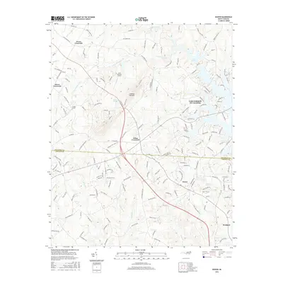
2016 Map of Denver
USGS Topo · Published 2016About this map
Lake Norman dominates the eastern horizon of this 2016 survey, where the waters of the Catawba River meet the eastern edge of Lincoln and Catawba counties. This modern landscape is defined by its transition from traditional Piedmont crossroads into growing residential communities. Historic hubs like Drums Crossroads, Olivers Crossroads, and Killian Crossroads anchor the road network, while the village of Denver serves as a central point of activity. The topography is marked by distinct elevations such as Anderson Mountain and Little Mountain, which rise above the drainages of S Fork Mountain Cr and Killian Cr. In the southeast, the development of Westport along the lakefront illustrates the shift toward water-oriented settlement. Local landmarks like Rock Springs and Jones Lake further characterize this region, where long-established family names are preserved in the myriad of secondary roads and local creeks.
Find a feature on this map
179 named features on this map. Tap any name to fly to it.
Don’t see what you’re looking for? This feature index may not catch every label — zoom into the map to look around manually.
Map Details
Editions of this 2016 Denver Map
This is the sole edition of this map. No revisions or reprints were ever made.
Other maps of this area

1893 · Statesville
USGS Topo · 1:125,000

1895 · Hickory
USGS Topo · 1:125,000

1914 · Gastonia
USGS Topo · 1:48,000

1916 · Gastonia
USGS Topo · 1:62,500

1941 · Charlotte
USGS Topo · 1:125,000

1942 · Charlotte
USGS Topo · 1:125,000

1949 · Hicks Crossroads
USGS Topo · 1:24,000

1953 · Charlotte
USGS Topo · 1:250,000

1954 · Charlotte
USGS Topo · 1:250,000

1960 · Charlotte
USGS Topo · 1:250,000