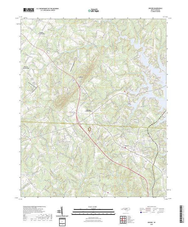
2022 Map of Denver
USGS Topo · Published 2022About this map
Denver and its surrounding crossroads serve as the focal point for this study of the landscape where Lincoln Co and Catawba Co meet. The modern development patterns are heavily influenced by the presence of Lake Norman, which dominates the eastern portion of the map with its intricate fingers and coves. Further west, the terrain rises toward prominent local elevations including Anderson Mountain and Little Mountain, which dictate the winding paths of rural roads and the drainage of numerous creeks like S Fork Mountain Cr and Killian Cr.
Find a feature on this map
184 named features on this map. Tap any name to fly to it.
Don’t see what you’re looking for? This feature index may not catch every label — zoom into the map to look around manually.
Map Details
Editions of this 2022 Denver Map
This is the sole edition of this map. No revisions or reprints were ever made.
Other maps of this area

1893 · Statesville
USGS Topo · 1:125,000

1895 · Hickory
USGS Topo · 1:125,000

1914 · Gastonia
USGS Topo · 1:48,000

1916 · Gastonia
USGS Topo · 1:62,500

1941 · Charlotte
USGS Topo · 1:125,000

1942 · Charlotte
USGS Topo · 1:125,000

1949 · Hicks Crossroads
USGS Topo · 1:24,000

1953 · Charlotte
USGS Topo · 1:250,000

1954 · Charlotte
USGS Topo · 1:250,000

1960 · Charlotte
USGS Topo · 1:250,000